Wildfire Risk Assessment Tools Insights for October
When it comes to protecting our precious forests, understanding wildfire risks is more important than ever. Every year, wildfires threaten vast stretches of woodland, wildlife habitats, and nearby communities. Over time, I have come to appreciate that prevention doesn't just happen by chance—it requires informed decisions guided by reliable tools. That is where wildfire risk assessment tools come into play.
Why Wildfire Risk Assessment Matters to Me
As someone who spends a lot of time in the outdoors—hiking, camping, and enjoying nature's peace—I know firsthand how fragile these landscapes can be. Wildfires don't only scorch trees. They wipe out habitats, endanger animals, pollute air, and disrupt lives. Facing this reality has pushed me to learn about methods that help gauge wildfire danger before flames take hold. These tools empower me and others to act proactively and protect our environment.
What Wildfire Risk Assessment Tools Are
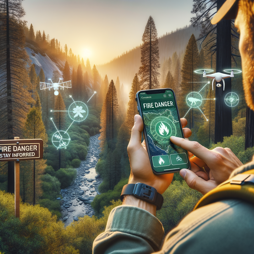
Simply put, wildfire risk assessment tools help predict where and when fires are likely to start, how they might spread, and their potential impact. They combine data from weather, vegetation, topography, and human activity to create clear risk maps or alerts.
Here are the key kinds of tools I rely on or monitor:
-
Satellite Monitoring Systems: Satellites scan forests for heat anomalies and smoke plumes, enabling early fire detection even in remote areas.
-
Fire Danger Rating Apps: These mobile apps provide real-time updates about fire weather conditions—like dryness, wind speed, and temperature—helping users understand daily risk levels.
-
Drones with Thermal Sensors: Drones fly over vulnerable terrain to detect hotspots invisible to the naked eye. They can pinpoint small flare-ups before they turn into major fires.
-
Predictive Modeling Software: Complex algorithms analyze historical fire data with current conditions to forecast potential fire behavior and spread patterns.
How I Use These Tools in Practice
Wildfire risk assessment is not only for firefighters or land managers. As a concerned outdoor enthusiast, I have integrated these tools into my routine whenever I plan to venture outside.
-
First, I always check local fire danger ratings through government or trusted apps. If the risk is high, I reconsider trips or avoid making fires.
-
I use satellite and drone data reports shared online to stay informed about any nearby fire activity.
-
By understanding predictive forecasts, I stay prepared for sudden changes in weather that could fuel fires.
My approach is simple: awareness leads to better decisions. It helps me advise friends and family as well about the safest ways to enjoy nature responsibly.
The Role of Community and Technology Working Together
Technology alone cannot stop wildfires, but combined with strong community engagement, it dramatically improves prevention efforts.
Volunteer lookout programs use these risk tools to monitor forests closely. Local authorities rely on early warnings to impose timely fire bans or evacuation alerts. Educational campaigns powered by fire risk information help everyone from campers to farmers make safer choices.
In my experience, sharing data openly empowers more people to join wildfire prevention efforts. When a community understands the real threats and has tools to assess risks, the outcome is hope—not helplessness.
Why This October Matters
Fall brings a unique twist to wildfire risks. Dry leaves, cooling temperatures, and shifting winds create different conditions than summer months. Wildfire risk assessment tools adjust their models accordingly to provide season-specific insights.
This October, I encourage you to frequently check updated risk reports before heading outdoors. Stay responsive to changing fire danger levels and always comply with local fire regulations. Doing so protects not only our forests but also the health of communities that rely on them.
Final Thoughts: Making Every Decision Count
The question I often ask myself—Can wildfire risk assessment tools truly make a difference? The answer is a confident yes.
These tools don’t just highlight danger zones. They guide individuals, officials, and rescue teams to act faster and smarter. In the battle against wildfires, forewarned is forearmed. Every alert followed, every precaution taken, and every piece of information shared helps safeguard our environment.
I invite you to incorporate wildfire risk assessment into your outdoor planning. By staying informed and prepared, we honor our responsibility to protect nature’s treasures for today and generations ahead.
Remember, when it comes to wildfires, prevention starts with knowledge. Use risk assessment tools wisely, stay vigilant, and let's reduce wildfire damage together.